
Exploring the Drys to Kionia Trail in Machairas
- Catherine

- Mar 3, 2021
- 1 min read
Updated: Apr 20
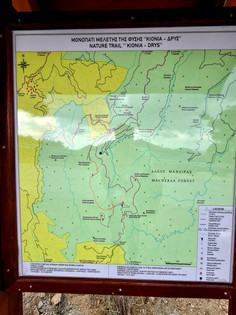
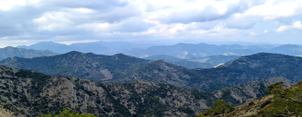
We started at the location named Drys, about 950 meters in altitude, just before the final junction to Machairas Monastery. The Kionia-Drys trail is a 3.5 kilometer path that winds steadily through the Machairas Forest, climbing toward Kionia peak. Along the way, the air is filled with the scent of pine and the soft rustle of leaves underfoot. The path takes you through open rocky sections and shaded pine slopes. From the summit, sweeping views unfold across the Mesaoria plain and distant valleys, with the distinctive white telecommunications dome over Kionia visible against the horizon. The trail is marked with E4 signs, and there are several spots perfect for pausing to enjoy the scenery or take photos.
Practical information:
Length: 3,5km - Linear
Estimated duration: 90 minutes
Difficulty rate: 2 – Mostly uphill
Starting point: The last junction before Machairas Monastery and Drys
If you want the easier version of this trail you can start from the dirt road after the Kionia picnic site. The trail Kionia-Drys has a moderate degree of difficulty, with some elevation variations.
The trail ends on a dirt road near the Kionia picnic site, where a fountain with fresh drinking water awaits. Most of the trail is exposed, so it is best enjoyed outside of summer. Sturdy hiking shoes are recommended as the path can be rocky in many places. Hiking this trail feels like stepping into a quiet, elevated world where the forest and mountains meet the sky.


Comments